Find your local screening service
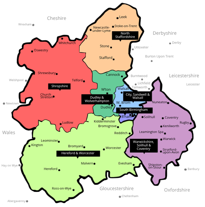
Our region covers a large area, illustrated on the map below. This includes the following major towns, covered by one of the seven services listed below. Please note that due to recent border changes, the services now cover the following areas:
Please click on the relevant part of the map or on the blue links below to be taken to your chosen service.
Based on Ordnance Survey material Boundary-Line product. Crown copyright 2010. All rights reserved. (O.S. Licence No. 100020290). Prepared under licence by West Midlands Cancer Intelligence Unit (2010).
Leek, Stoke-on-Trent, Newcastle-under-Lyme, Stone, Stafford
Whitchurch, Oswestry, Shrewsbury, Telford, Church Stretton, Ludlow
Dudley, Wolverhampton, Whitmore Reans, Woodside, Cradley, Cannock
Walsall, Wednesbury, West Bromwich, Oldbury, Sutton Coldfield, Handsworth Wood, Aston
Birmingham, Warley, Edgbaston, Selly Oak, Cotteridge
Kidderminster, Redditch, Worcester, Leominster, Hereford, Malvern, Evesham, Ross-on-Wye, Bromsgrove, Kington, Bromyard, Tenbury, Pershore
Nuneaton, Solihull, Coventry, Rugby, Kenilworth, Leamington Spa, Warwick, Stratford-upon-Avon, Shipston-on-Stour